Mission Statement
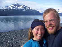
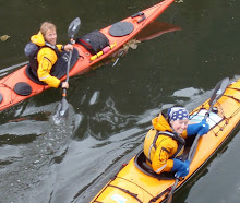
We, Chris Behnke and Corinna Cook, are pleased to devote the summer months of 2009 to a themed kayak exploration of Southeast Alaska. We plan to paddle roughly one thousand miles from Misty Fjords to Glacier Bay and to compile a photo project treating the subject of land and resource conservation in the Tongass National Forest.
The United States Forest Service (USFS) manages most of the Tongass National Forest. One hundred years of extraction-based federal management has resulted in a scarred landscape and a dependence on federal subsidies among Southeast Alaska communities. Private corporations have also contributed to the incrimental destruction of our temperate coastal rainforest. Through ANCSA, the Alaska Native corporations were given control of large blocks of the Tongass in the form of land allotments. A number of these corporations in Southeast have methodically clearcut much of their land with little or no regard to sustainable timber practices. With the end of the fifty-year contracts which have dominated USFS policy in the 1990s, the ensuing collapse of the regional pulp mill economy, and the Native corporations' widespread practice of sending its timber to be processed overseas, Southeast Alaskan towns have struggled to remain economically viable communities. Southeast Alaska’s population is shrinking, and questions of our future in this place are critical.
As members of and participants in a market-driven society, as creatures of a coastal forested ecosystem, and simply as homegrown Alaskans overflowing with love for our northern world, we intend to experience and document our temperate rainforest's logging scars firsthand. We wish to understand and expose the effects of corporate natural resource control. We will explore the edges os forests that are going to be cut, forests that have been cut, sites of potential hydrological power development, sites of potential mineral development, and areas that, for the time being, remain unhurt and unthreatened by the burgeoning development around us.
Ernest Sound

North of Meyers Chuck we encountered mysterious orange ocean-haze. We asked each other, what is a red tide? Is this a red tide? The orange got on our kayaks, our paddles, our boots, the shoreline, everything. Needless to say, we ate no shellfish.

Some of the slowest paddling possible took place on this piece of water. Innocent though it looks, it is possesed by a siren-like countercurrent that nearly held us at a stand-still. The island in the background is also touched: even at this distance the air was still shaking with the grunts and barking and groaning burps of sea lions hauled out on the granite.


A spritely tide whisked us in and among these islets which dot the shore of Deer Island. It was a welcome change from the invisible current bogging us down a few days earlier.

This is how a clearcut looks after it has had time to green up. Even though the greenery makes for a bit of a jungle right now, trees of uniform height will grow and will eventually block the sun from reaching the understory. Little vegetation of any nutritional value to deer, for example, will survive. Decades from now, when this patch looks again like a forest to those of us out on the water, wildlife will still be forced to avoid the area.

A surprise encounter: this floating building tucked into a cove on Deer Island is used by Crossings, an organization that launches troubled teens on month-long canoe trips in Southeast Alaska.
 North of Meyers Chuck we encountered mysterious orange ocean-haze. We asked each other, what is a red tide? Is this a red tide? The orange got on our kayaks, our paddles, our boots, the shoreline, everything. Needless to say, we ate no shellfish.
 Some of the slowest paddling possible took place on this piece of water. Innocent though it looks, it is possesed by a siren-like countercurrent that nearly held us at a stand-still. The island in the background is also touched: even at this distance the air was still shaking with the grunts and barking and groaning burps of sea lions hauled out on the granite.
 A spritely tide whisked us in and among these islets which dot the shore of Deer Island. It was a welcome change from the invisible current bogging us down a few days earlier.
 This is how a clearcut looks after it has had time to green up. Even though the greenery makes for a bit of a jungle right now, trees of uniform height will grow and will eventually block the sun from reaching the understory. Little vegetation of any nutritional value to deer, for example, will survive. Decades from now, when this patch looks again like a forest to those of us out on the water, wildlife will still be forced to avoid the area.
No comments:
Post a Comment